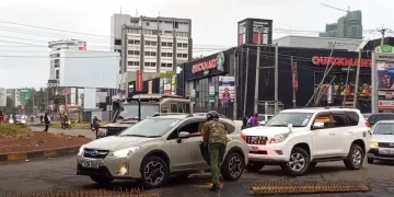


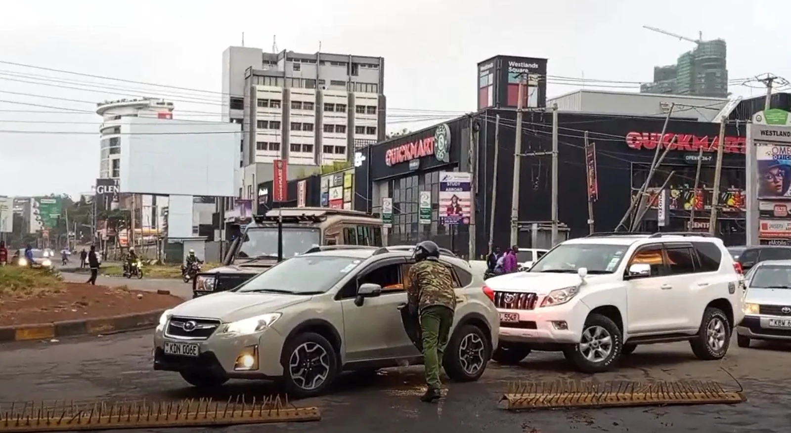
Nairobi and its environs was brought to a near standstill today after police erected barricades across major roads and highways leading into the CBD in anticipation of protests.
The security clampdown intended to deter Saba Saba demonstrations, caused massive traffic jams, delays for commuters, and disruption to businesses.
As a result of the chaos caused, a timely digital solution has emerged to help Nairobi residents who need to move through the city’s heavily restricted roads and highways.
A new platform, nairobi-cbd-barricades.vercel.app, is now offering real-time visibility into where barricades are located. Built by Nairobi-based developers responding to the crisis, the platform uses crowdsourced updates to mark roads that are currently blocked by police or difficult to access.
Major roads and highways like Thika Superhighway, Mombasa Road, Waiyaki Way, and Jogoo Road are clearly flagged, which helps users plan alternative routes before leaving home or while on the move.
The interface is clean and interactive, displaying a live map of Nairobi with marked icons representing various types of roadblocks, ranging from metal fences to police vehicles.
Users can toggle between views and zoom into specific junctions. The real power of the platform, though, is its collaborative model that enables commuters and riders to report new barricades, allowing the map’s developer to update in real time.
For residents dealing with grounded matatus, unexpected road closures, and long treks on foot, the platform has already proven invaluable.
People within Nairobi can avoid bottlenecks and find accessible paths into and around the CBD, especially for urgent commutes to hospitals, offices, and critical deliveries.
This app also builds on the legacy of Nairobi’s past civic-tech innovations like the Digital Matatus project. But unlike government transport apps, this one sprang up almost overnight, proving how rapidly digital communities in Kenya can respond to crises with practical tools.


