Google Maps is one of the well known tools that Google offers to everyone for free. We use it for directons to a point of interest or discovering where a point of interest is. Another major use of Google Maps is using it to track traffic jams.
A green line shows that the road is clear and orange to red means that there is moderately to heavy traffic on the route. Smartphones have GPS sensors onboard so Google uses data obtained anonymously to crowdsource the traffic sitution of a road. The company uses the average speed of cars plying the same route to predict the traffic situation of that road.
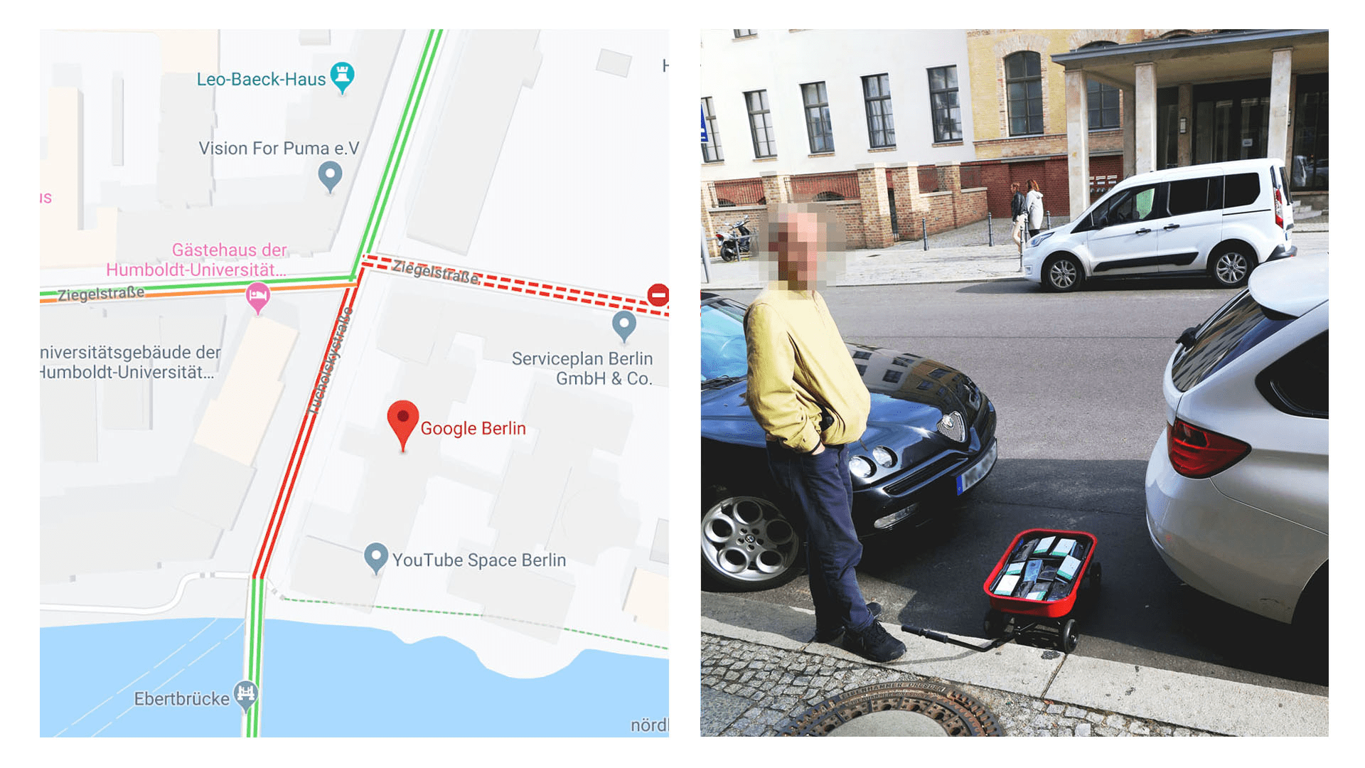
One performance artist decided to take this knowledge to the test where he was able to manipulate traffic view conditions on maps using a bevy of smartphones.
He used 99 second hand smartphones which were transported in a handcart to generate virtual traffic jam on Google maps.
As he moved along the street, the traffic live view on Google Maps progressively changed from green to yellow to orange to red. The insane thing about it is that the street had no traffic at all, which uncovered a major loophole on Google Maps.
This trick worked because the guy had quite a number of smartphones in a small location (99) and his walking speed could mimic a heavy jam. This means that Google will now have to find another way to give the data some perspective so as to simulate an actual traffic jam. A great way will be using radar which will transmit data that shows the surroundings and that will help in traffic predictions, but it will raise a whole tsunami of data privacy so it might not happen in the near future.


