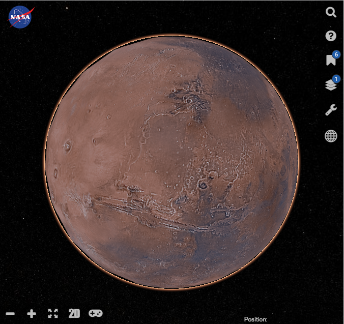


 NASA announced an interactive web based tool that looks like Google Earth for exploring Mars called Mars Trek. Just like how you can visit places all over the world on Google Earth, you can explore Mars in either 2D or 3D. Apart from virtually exploring around Mars, you can also perform analysis on data.
When you first login to the website, you are greeted with a tutorial that shows you its features. First of all are the tools on the right side of the interactive map and they include:
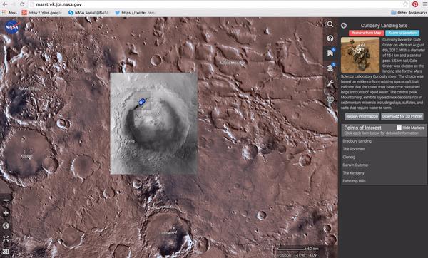
- The search panel is used to find features on Mars that you know of and once you click it.
- The Map selection panel which gives you options to view Mars from a global, northern polar or southern polar view.
- Tools panel which can be used by expert users for various analysis operations. It is only available in 2D mode
- My data panel which is essentially for layers where you can add several layers from the ones available onto maps to get even more information.
- Bookmarks panel has areas of interest that you may want to check out like landing sites or major features. You click on “Add Bookmark to Map” on the bookmark of choice and the point of interests will be displayed.
- The Help panel will give you more information on how to use Mars Trek.
There are other tools on Mars Trek like Zoom controls, 2D/3D toggles, full screen toggle, 3D game toggle where you can use the arrow keys to control the zoom & the mouse to drag and Map Info that shows you the scale & position coordinates.
It is an interesting tool for those people who are interested in Interstellar objects and want to explore Mars from the comfort of your computer. You can also use Google Earth to explore Mars which also has an extensive list of tools that you can use to manipulate the map or do analysis.


