




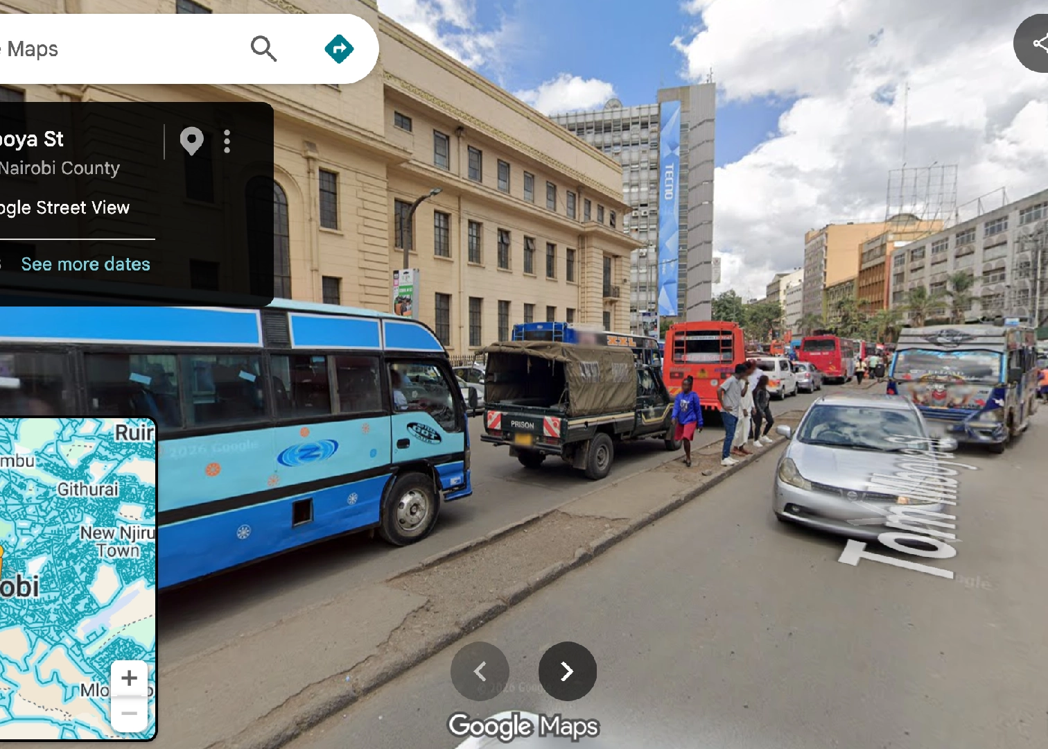
In September 2015, a small fleet of Google’s imaging equipment rolled quietly into the Samburu National Reserve in northern Kenya. It involved 360-degree cameras capturing acacia trees, elephants, and the wide red earth of one of Africa’s most storied wildlife reserves.
This marked a modest beginning, framed around conservation and virtual safari tourism rather than urban navigation. Kenya, almost by accident, has become one of the first African nations to host Google Street View.
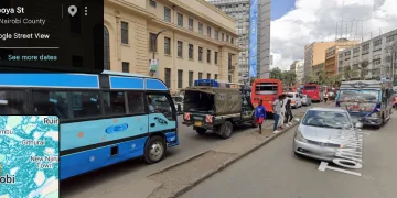
Three years later, it became a full occupation. On October 4, 2018, Google unveiled 9,500 kilometers of street-level imagery stretching across Nairobi, Mombasa, Eldoret, Nakuru, Nyeri, and Malindi.
It was billed as a tourism and small-business tool, a way for a hotel in Malindi or a shop in Nakuru to be discovered by someone scrolling a map thousands of miles away.
The cameras kept coming back as Kisumu joined the network in 2022 with newer, sharper hardware, and by the end of 2023, Kenya held the distinction of being the most recently refreshed Street View map on the entire continent.
The coverage map below shows just how uneven this rollout has been across the continent. The pale blue tracing along coastlines, capitals, and select corridors is Street View’s actual reach; everywhere else is untouched.
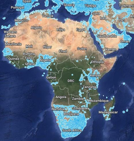
Even at a glance, the pattern is visible: Kenya, South Africa, Nigeria, Ghana, and Botswana show dense clusters of coverage, while much of Central and Francophone West Africa remains largely blank.
East Africa: A Study in Contrasts
While Kenya boasts 9,500 kilometers of comprehensive coverage, its regional neighbors present a starkly different picture.
| Country | Status | Coverage Details | Official Language |
| Kenya | Full Coverage | 9,500 km across major cities (Nairobi, Mombasa, Kisumu) | English, Swahili |
| Tanzania | Landmarks Only | Mount Kilimanjaro National Park, Gombe Stream National Park | Swahili, English |
| Uganda | Limited | Roads inside and around Entebbe and Kampala | English, Swahili |
| Rwanda | Emerging | Capital city Kigali, expanded to Byumba, Nyagatare | Kinyarwanda, English, French |
| Ethiopia | No Coverage | None officially available | Amharic, English |
Despite sharing a border with Kenya and a comparable tourism sector, Tanzania’s coverage is limited to a couple of national parks. Uganda and Rwanda have mapped little beyond their capitals. Ethiopia, the continent’s second most populous country, has no official coverage at all.
The Wider Continent
Zooming out, Kenya’s position looks less like an outlier and more like membership in a select club of nations with comprehensive coverage.
| Country | Status | Coverage Details | Official Language |
| South Africa | Full Coverage | Most major cities and roads (launched 2010 for FIFA World Cup) | English (among others) |
| Nigeria | Extensive | Major cities (Lagos, Abuja) and connecting roads, updated with Gen 4 cameras | English |
| Ghana | Extensive | Major cities (Accra, Kumasi), national highways (N10, N12, N2) | English |
| Botswana | Full Coverage | Major urban areas (Gaborone, Francistown) and national parks | English |
| Morocco | Limited/ Exception | Few select tourist attractions; no major official road coverage | Arabic, French, Berber |
| Senegal | Moderate/ Exception | Cities including Dakar, Saint Louis, Thies, Touba | French |
South Africa leads the continent, its coverage seeded by the 2010 World Cup. Nigeria and Ghana, both English-speaking West African nations, have expanded steadily since, with Ghana receiving a fresh imaging pass over its national highways in mid-2026.
Why the Google Street View Map Looks Like This
Lining these tables up against a language map reveals a pattern too consistent to be coincidence. The nations with full or extensive coverage, Kenya, South Africa, Nigeria, Ghana, and Botswana, are overwhelmingly Anglophone.
Google’s expensive camera fleet appears to follow the markets where its advertising and mapping products already have the deepest reach, and that reach still tracks closely with English-language use.
Senegal and Morocco are the notable exceptions, Francophone and Arabic-speaking nations with partial coverage in Dakar and a scattering of Moroccan landmarks, but neither matches the density seen across Anglophone Africa.
READ: Google Adds More Locations To Street View From Uganda, Senegal And Ghana
Meanwhile, large Francophone and Lusophone nations, Ivory Coast, the Democratic Republic of Congo, Angola, and Mozambique, remain largely blank.
Security plays its part too, where Nigerian Street View cars have needed police escorts, and the conflict-affected Sahel, Mali, Burkina Faso, and Niger remain entirely unmapped.
What emerges is a continent mapped unevenly, shaped less by geography than by language and stability. Kenya sits at the intersection of all three as an English-speaking population, a tourism economy that rewards visibility, and enough peace to keep the cameras rolling year after year.
In other words, the coverage map shows something simple whereby Google has decided it’s worth the money and safe enough to send its cars one country at a time.