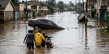


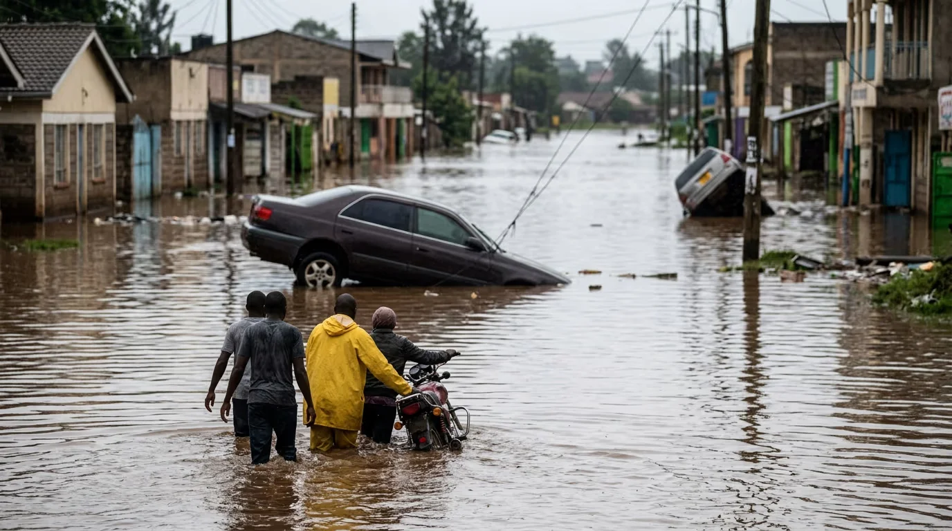
When floodwaters tore through Nairobi neighborhoods last weekend, they left 26 people dead in the capital alone. Across Kenya, the toll reached 42.
The devastation was horrific. In settlements along the city’s riverbanks, families watched surging water sweep their homes away.
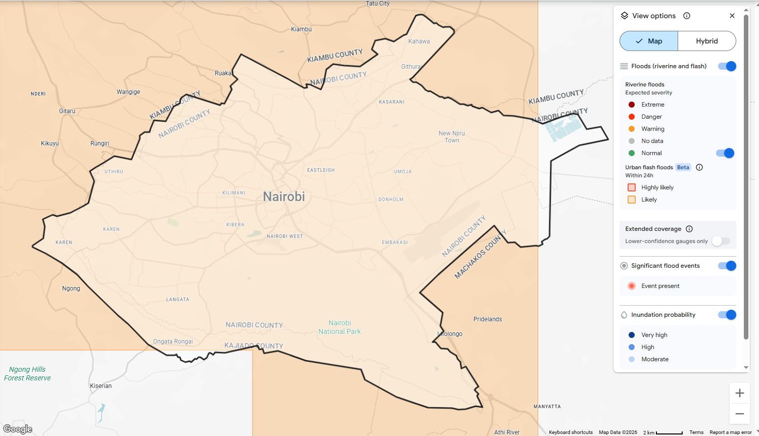
It is exactly the kind of disaster that an AI model from Google is designed to help prevent. This week, the tech giant announced the rollout of urban flash flood forecasts on its Flood Hub platform.
This is a system capable of predicting flash flood risk in cities up to 24 hours in advance.
The challenge has always been data. Unlike river floods, where physical gauges track rising water levels over days, flash floods strike within 6 hours of heavy rainfall, anywhere in a city, with little warning.
In addition, historical records of exactly where and when they had occurred have not been reliable, making it nearly impossible to train predictive AI models.
Flood Hub Enhanced by Public Data
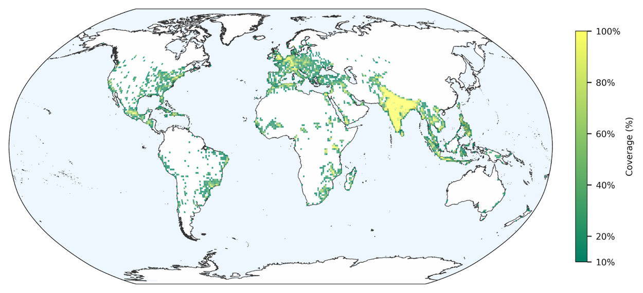
Google’s answer was a methodology it calls Groundsource. Using its Gemini AI, the company combed through decades of publicly available news reports, identifying and verifying over 2.6 million historical flood events across more than 150 countries.
That dataset from public information was then used to train a new model that can assess, in near real-time, whether a flash flood is “likely to occur in this area in the next 24 hours.”
For a country like Kenya, where millions live in dense urban settlements along flood-prone waterways, the implications are profound. That kind of advance notice could be the difference between evacuation and tragedy.
“Even a 12-hour lead time can provide a 60% reduction in flash flood damage,” says Google, citing global flood research.
With the new data, Google’s Flood Hub has significantly scaled and evolved to tackle urban flash floods. By targeting high-risk areas with population densities exceeding 100 people per km², this update brings life-saving data directly to the dense metropolitan hubs where the need is most urgent.
Flood Hub is publicly accessible, meaning any resident, local government official, or emergency responder in Nairobi, or anywhere else in the world, can check flood risk forecasts for their area directly, at no cost.
Google’s CEO, Sundar Pichai, confirmed the open access in a post stating, “We’re open-sourcing this dataset to advance global research, and urban flash flood forecasts are live now in Flood Hub to help communities stay safe.”
Flash floods are the deadliest form of flooding, responsible for 85% of all flood-related fatalities and over 5,000 deaths annually, according to the World Meteorological Organization.
Google says it plans to expand the model’s reach to rural areas, improve spatial resolution for more localized forecasts, and apply the same GroundSource methodology to other disasters, including landslides and heat waves.
For the families and businesses in Kenya who lost everything last weekend, that future cannot come soon enough.


